In the heart of the Brazilian Amazon Rainforest, a technological breakthrough is taking flight, promising to revolutionize environmental monitoring and security. Researchers have recently unveiled a pioneering dataset designed to detect and segment unauthorized airstrips using Synthetic Aperture Radar (SAR) imagery from the Sentinel-1 satellite. This innovation, spearheaded by Leandro da Silva Gomes of the Aeronautics Institute of Technology (ITA) in Brazil, is set to transform how we monitor and protect some of the world’s most critical ecosystems.
The Brazilian Amazon, a region teeming with biodiversity and economic potential, faces relentless threats from illegal activities such as logging, mining, and drug trafficking. These activities often rely on unauthorized airstrips, which are notoriously difficult to track due to the region’s persistent cloud cover. Traditional optical satellites frequently fall short in these conditions, but SAR imagery offers a reliable alternative, penetrating cloud cover to provide clear, detailed images.
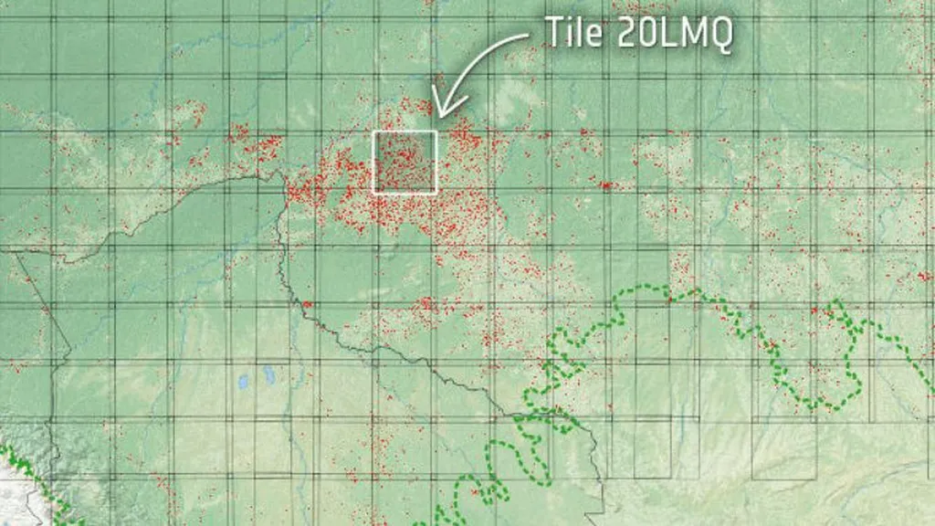
Gomes and his team have compiled a comprehensive dataset that includes SAR images from 2021 to 2024, covering 1040 known airstrip locations sourced from the MapBiomas project. The dataset also includes historical images from 2014 to 2021 to support change detection tasks, allowing researchers to identify new airstrip constructions. “This dataset is a game-changer,” says Gomes. “It provides the necessary tools to train machine learning models, including deep learning algorithms, to automatically detect and segment these airstrips, even in the most remote and cloud-covered regions.”
The dataset is structured to support three key machine learning tasks: object detection, semantic segmentation, and change detection. For object detection, models like YOLOv8 can be employed to identify the precise locations of airstrips. Semantic segmentation, using models like U-Net, can delineate the boundaries of these airstrips, while change detection helps monitor new constructions over time. “The integration of these tasks allows for a comprehensive monitoring system,” explains Gomes. “This can be invaluable for environmental agencies, security forces, and even the energy sector, where monitoring infrastructure and illegal activities is crucial.”
The implications for the energy sector are particularly significant. Energy companies operating in remote regions often face challenges in monitoring their infrastructure and detecting illegal activities that could disrupt operations or cause environmental damage. This dataset and the resulting machine learning models can provide automated, real-time monitoring solutions, enhancing security and operational efficiency. “By leveraging this technology, energy companies can better protect their assets and contribute to the sustainability of the regions they operate in,” Gomes adds.
The dataset is now available on the Mendeley Data repository, offering researchers and industry professionals a valuable resource for developing advanced monitoring systems. Published in the journal ‘Data in Brief’ (translated to English as ‘Short Data Reports’), this work highlights the potential of SAR imagery and machine learning in environmental and security applications.
As we look to the future, this research paves the way for more sophisticated and automated monitoring systems. The ability to detect and segment unauthorized airstrips using SAR imagery and machine learning models opens up new possibilities for environmental protection, security, and even commercial applications in the energy sector. Gomes’ work is a testament to the power of technology in addressing some of the most pressing challenges of our time, offering hope for a more sustainable and secure future.