In the heart of China’s Upper Yangtze watershed lies Sancha Lake, a reservoir of complexities that has long stumped conventional bathymetric mapping techniques. The murky waters and varied lakebed have made it a formidable challenge for optical remote sensing methods, which typically rely on spectral signals to estimate water depth. However, a groundbreaking study led by Xiaojuan Li from the School of Geographical Sciences at China West Normal University has turned the tables on these long-held assumptions, demonstrating that geographic features can drive bathymetric accuracy in turbid waters.
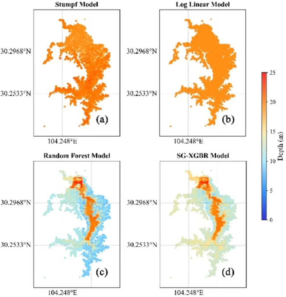
Published in the *Science of Remote Sensing* (translated from Chinese as 遥感学报), the research introduces the Spectral-Geospatial XGBoost Regression (SG-XGBoost) model, a machine learning approach that integrates spectral transformations with geographic coordinates. The results are nothing short of revolutionary. “We achieved an R² of 0.91 and an RMSE of just 1.66 meters,” Li explains, “This represents a 70% improvement over traditional empirical methods and a 21% advancement beyond Random Forest.”
The implications for the energy sector are profound. Accurate bathymetric mapping is crucial for hydropower projects, which often involve complex inland water bodies. “Our method can capture fine-scale morphological features, like channels less than 30 meters wide and subtle depth variations of 1–2 meters, which are invisible to conventional approaches,” Li adds. This level of detail is invaluable for site selection, infrastructure planning, and environmental impact assessments.
The study’s most unexpected finding? Geographic coordinates dominated predictive power, contributing 85% to the model’s accuracy, while spectral features contributed minimally. This challenges fundamental assumptions about optical bathymetry and opens new avenues for research. “We’re seeing that spatial-spectral interactions are key,” Li notes. “The iterative error correction and sophisticated regularization of gradient boosting methodology enable us to exploit these interactions effectively.”
While the model has limitations—extreme turbidity and site-specificity require readjustment for new water bodies—it establishes gradient boosting with spatial-spectral integration as a transformative approach for inland water bathymetry. The broader implications for aquatic remote sensing applications, including water quality monitoring and habitat mapping, are vast.
As the energy sector increasingly turns to renewable sources, accurate and efficient mapping of inland water bodies will be critical. Li’s research not only advances the field of remote sensing but also provides a powerful tool for the energy industry. “This is just the beginning,” Li says. “We’re excited to see how this method will shape future developments in the field.”
In a world where data drives decisions, the ability to accurately map complex water bodies is a game-changer. Xiaojuan Li’s work is a testament to the power of innovation and the potential of machine learning to revolutionize traditional practices. As the energy sector continues to evolve, so too will the tools and technologies that support it, thanks in part to pioneering research like this.