In a groundbreaking development for spatial data acquisition, researchers have successfully integrated Unmanned Aerial Vehicle (UAV) LiDAR technology with GNSS RTK/PPK positioning to achieve centimeter-level precision in geospatial mapping. This innovative approach, detailed in a recent study published in ‘Micro, Macro & Mezzo Geoinformation’ (translated as ‘Micro, Macro & Mezzo Geoinformation’), opens new avenues for high-accuracy spatial data in geodesy, civil engineering, cadastre, and environmental monitoring. The research, led by Nikola Kranjčić from the University North, Department of Geodesy and Geomatics, highlights the transformative potential of this technology for commercial applications, particularly in the energy sector.
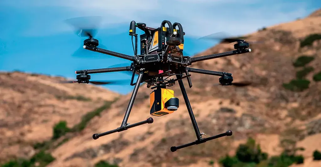
The study conducted surveys in Croatia and Bosnia and Herzegovina, leveraging the CROPOS and FBiHPOS GNSS networks respectively. These networks provided the necessary infrastructure to ensure compatibility with national and European coordinate systems, such as HTRS96/TM and MGI 1901/Balkans zone 6. The use of a DJI Matrice 350 RTK UAV equipped with a DJI Zenmuse L2 LiDAR sensor, supported by an Emlid Reach RS2 GNSS receiver, enabled surveys with remarkable accuracy. The results showed an RMSE of X = 0.006 m, Y = 0.005 m, and Z = 0.007 m, demonstrating the precision of the methodology.
Nikola Kranjčić emphasized the significance of this research, stating, “The integration of UAV-LiDAR with national GNSS infrastructures not only ensures compatibility with existing systems but also strengthens interoperability with European systems like ETRS89. This is crucial for sustainable and harmonized spatial data infrastructures.”
The data processing, carried out using DJI Terra and Lidar360, produced dense point clouds exceeding 240 points per square meter, high-resolution orthophotos with a ground sampling distance of 2–3 cm, and detailed Digital Elevation Models (DEM) and Digital Surface Models (DSM). These high-accuracy datasets are invaluable for scientific research, engineering applications, and long-term monitoring.
For the energy sector, the implications are profound. High-accuracy spatial data is essential for planning and monitoring energy infrastructure, such as pipelines, power lines, and renewable energy projects. The ability to conduct precise surveys quickly and efficiently can significantly reduce costs and improve project outcomes. As Kranjčić noted, “This technology can revolutionize how we approach energy infrastructure projects, ensuring better planning, reduced environmental impact, and improved safety.”
The study also underscores the importance of cross-border geospatial interoperability, which is vital for regional cooperation and the seamless integration of energy networks across borders. By ensuring compatibility with European systems, this research paves the way for more cohesive and efficient spatial data infrastructures.
As the energy sector continues to evolve, the demand for high-accuracy spatial data will only grow. This research provides a robust framework for meeting these demands, offering a glimpse into the future of geospatial technology. With the continued advancement of UAV LiDAR and GNSS technologies, we can expect even greater precision and efficiency in spatial data acquisition, shaping the future of geodesy, civil engineering, and environmental monitoring.
In the words of Kranjčić, “This is just the beginning. The potential for UAV LiDAR and GNSS integration is vast, and we are excited to see how this technology will continue to evolve and impact various industries.”