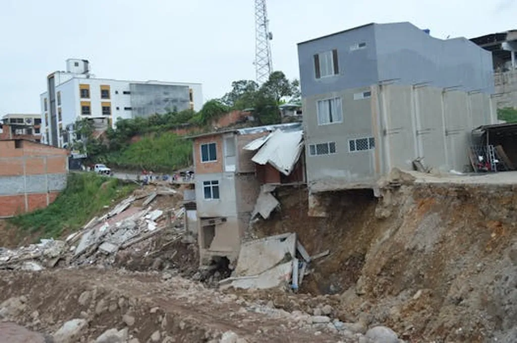
In the wake of the devastating Wenchuan earthquake, the landscape of Beichuan County in Sichuan Province was irrevocably altered, not just by the initial seismic event but by the cascading geological disasters that followed. Among these, landslides emerged as a persistent and formidable challenge, reshaping the terrain and posing significant risks to both the environment and local communities. Now, a groundbreaking study led by Qinghai Deng from Shandong University of Science and Technology, published in *Acta Scientiarum: Technology* (which translates to *Acta Scientiarum: Technology*), sheds light on the evolution and control factors of these landslides, offering crucial insights for disaster prevention and mitigation.
The research, which spanned a 13-year period from 2007 to 2019, utilized advanced remote sensing images from ALOS, GF-1, and ZY-3 satellites, coupled with GIS technology, to meticulously analyze the development of landslides in Beichuan County. The findings reveal a stark contrast between the pre- and post-earthquake landscape. “After the Wenchuan earthquake, the number and area of landslides in Beichuan County drastically increased,” Deng explains. This surge in landslide activity was particularly pronounced in the five years following the earthquake, although the landscape has not yet fully returned to its pre-earthquake state.
One of the most intriguing aspects of the study is the migration of high-risk landslide areas. Initially, landslides were concentrated in medium- and high-altitude regions with steep slopes. However, over time, these high-risk zones began to shift towards areas with lower altitudes and gentler slopes. This spatial evolution is a critical factor for future disaster prevention strategies, as it highlights the dynamic nature of geological hazards in earthquake-stricken regions.
The study also delves into the primary inducing factors of landslides before and after the earthquake. Before the disaster, river erosion was the main culprit. However, post-earthquake, the landscape was dominated by landslides in the southeast and central parts of the county, areas with strong earthquake intensities. “This was attributed to seismogenic faults,” Deng notes. As the landscape gradually recovers, river erosion has once again emerged as the primary contributing factor.
The implications of this research extend far beyond academic interest. For the energy sector, understanding the spatio-temporal distribution and evolution of landslides is crucial for infrastructure planning and risk management. Energy projects, particularly those involving pipelines, transmission lines, and renewable energy installations, are highly susceptible to landslide-induced damages. By identifying high-risk areas and understanding the factors that trigger landslides, energy companies can make more informed decisions about project locations and implement more effective mitigation strategies.
Moreover, the study’s findings can guide the development of early warning systems and emergency response plans. By anticipating the migration of high-risk areas, authorities can proactively implement measures to protect critical infrastructure and ensure the safety of local communities. This proactive approach can significantly reduce the economic and environmental impacts of landslides, ultimately fostering a more resilient and sustainable energy sector.
As we look to the future, the research conducted by Qinghai Deng and his team serves as a beacon of hope in the ongoing battle against geological disasters. By unraveling the complexities of landslide evolution, this study paves the way for more effective disaster prevention and mitigation strategies, ensuring a safer and more sustainable future for earthquake-stricken regions. The insights gleaned from this research are not just academic exercises; they are practical tools that can shape the future of disaster management and energy infrastructure development.