In the realm of environmental monitoring and sustainable resource management, a groundbreaking review published in *Chemical Engineering Transactions* (translated from Italian as *Transactions on Chemical Engineering*) is making waves. The study, led by Szeverin Oláh, delves into the transformative potential of point cloud upsampling for enhancing airborne LiDAR data. This technology could revolutionize how we manage our natural resources, particularly in the energy sector, by providing high-resolution, dynamic geospatial data that supports sustainable infrastructure and optimizes urban services.
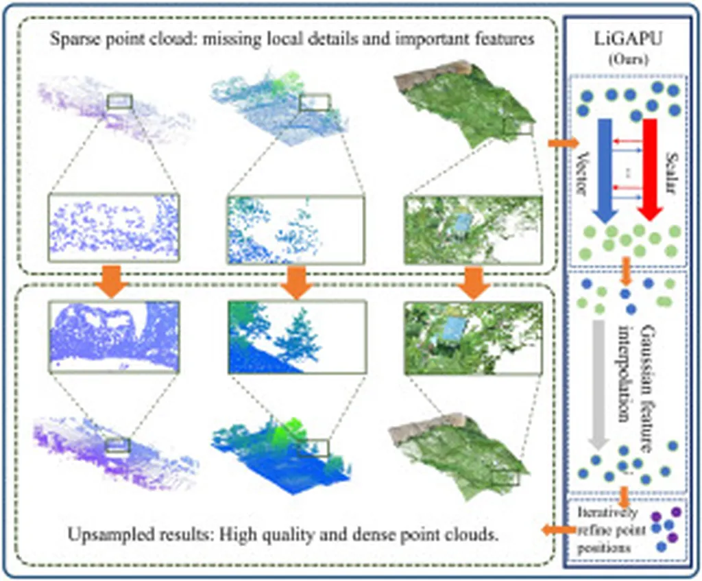
Airborne Laser Scanning (ALS) has become a go-to remote sensing technology for collecting vast datasets of 3D point clouds over extensive areas, including forests, river basins, coastal wetlands, and mountainous regions. These datasets are invaluable for analyzing vegetation structure, estimating biomass, modeling hydrology, and detecting land cover changes. However, the spatial resolution of ALS-derived point clouds is often limited, hindering fine-scale ecological and environmental modeling.
Enter point cloud upsampling—a technique that augments the spatial robustness of ALS point cloud data without the logistical burden of resurveying. “Upsampling is synthetic in nature, achieving increased data point count while maintaining dimensional integrity for continuity of surfaces and geometric fidelity,” explains Oláh. This enhancement is crucial for methodologies that rely on derived products such as digital terrain models, canopy height models, and vegetation metrics.
The review synthesizes existing upsampling algorithms and evaluates their relevance to forestry, watershed management, and conservation planning. Oláh emphasizes the importance of methodological bases for robustness and dimensionality, noting that enhanced points improve outcomes for ecological models. “The work establishes the understanding of point cloud enhancement for its visualization, but also its potential as an emergent action that contributes to construction and promotes a sustainability intention in environmental science and policy,” Oláh states.
For the energy sector, the implications are significant. High-resolution geospatial data can inform decisions related to renewable energy projects, such as wind farm placements and solar panel installations, by providing detailed insights into land cover and vegetation structure. This data can also support hydrological modeling, which is essential for managing water resources in energy production.
The review underscores the conceptual soundness of point cloud upsampling in the workflow of environmental monitoring. By enhancing data richness without incurring new costs for data generation, this technique offers a cost-effective solution for sustainable resource management. As Oláh’s work suggests, the future of environmental monitoring lies in leveraging advanced technologies like point cloud upsampling to make informed, sustainability-driven decisions.
In a world increasingly focused on sustainability, this research could shape future developments in environmental science and policy. By providing a structured conceptual framework for employing point cloud upsampling techniques, Oláh’s review paves the way for more accurate, efficient, and sustainable resource management practices. As the energy sector continues to evolve, the insights gained from this research could prove invaluable in achieving a more sustainable future.