In the bustling heart of our cities, a silent revolution is underway, one that promises to reshape urban management and sustainability. At the forefront of this transformation is a technology that might not yet be a household name but is making waves in the energy and urban planning sectors: LiDAR, and its cutting-edge cousin, point cloud upsampling. The latest research, led by Szeverin Oláh and published in the journal “Chemical Engineering Transactions” (translated to English as “Transactions on Chemical Engineering”), is shedding light on how these technologies can enhance the precision and efficiency of urban data, ultimately improving the quality of life for city residents.
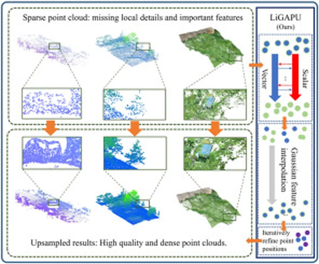
LiDAR, or Light Detection and Ranging, is a remote sensing method that uses light in the form of a pulsed laser to measure ranges (variable distances) to the Earth. This technology is already widely used to create detailed 3D models of urban environments, supporting everything from transportation planning to emergency response. However, the data collected, known as point clouds, often suffer from incompleteness or sparsity due to surveying costs, sensor characteristics, and environmental occlusion. This is where point cloud upsampling comes into play.
Point cloud upsampling is an innovative technique that synthetically increases point density while preserving geometric accuracy. According to Oláh, “Advanced point cloud upsampling methods can significantly improve the accuracy or precision of derived products such as digital terrain models (DTMs), canopy height models (CHMs), and other ecological indices that are generally sensitive to point density.” This enhancement can lead to more precise and reliable data, which is crucial for sustainable urban management.
The research highlights that deep learning-based networks have demonstrated substantial improvements in point cloud upsampling. For instance, previous studies have shown a reduction in point-to-surface deviation and improved distribution uniformity. Moreover, frequency-selective geometry upsampling provided up to 4.4× fewer point-to-point deviations compared to existing methods like PU-Net at 4× upsampling factors. These advancements are not just academic; they have real-world commercial impacts, particularly in the energy sector.
Imagine a city where energy infrastructure is optimized based on highly accurate, real-time data. With enhanced point cloud upsampling, urban planners and energy providers can better manage utility networks, plan green infrastructure, and respond to emergencies more effectively. This technology can lead to more efficient energy distribution, reduced costs, and a smaller carbon footprint—key goals for any sustainable city.
The research also proposes a new way of thinking and structuring data science that can scale into urban monitoring processes. This holistic approach could revolutionize how cities are managed, making them smarter, more efficient, and more resilient. As Oláh suggests, “This paper reviews the latest upsampling algorithms and proposes a way of thinking and structuring data science that can scale into urban monitoring processes.”
The implications of this research are vast. From improving the accuracy of digital terrain models to enhancing ecological indices, point cloud upsampling is poised to become a cornerstone of sustainable urban management. As cities around the world grapple with the challenges of urbanization and climate change, technologies like LiDAR and point cloud upsampling offer a beacon of hope. They provide the data-driven insights needed to build smarter, greener, and more livable cities.
In the words of Oláh, “The potential of these technologies to transform urban management is immense.” As we stand on the brink of this data-driven revolution, one thing is clear: the future of our cities is looking brighter—and more precise—than ever before.