In a groundbreaking stride towards revolutionizing geological data management and Earth system representation, the National Geological Data Center (NGDC) in China has laid the foundation for a comprehensive Geological Digital Twin. This ambitious project, detailed in a recent paper published by lead author X. Wu from the Development and Research Center of China Geological Survey in Beijing, promises to transform how we understand and interact with our planet’s subsurface.
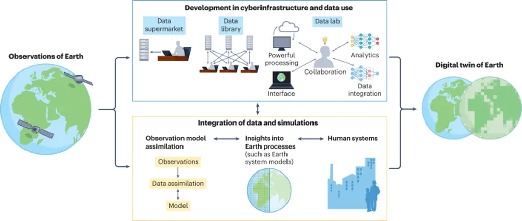
Imagine a digital replica of the Earth’s geological systems, where vast amounts of multi-dimensional data converge to create a dynamic, interactive model. This is precisely what NGDC is striving to achieve. By integrating data from diverse sources and scales, they are constructing a cohesive database cluster that serves as a digital twin of the subsurface. “Our goal is to enhance understanding, analysis, and decision-making for Earth system representation,” Wu explains, highlighting the transformative potential of this initiative.
The project’s innovative practices include establishing a standardized “receive, manage, utilize” data management system and deploying open service platforms, such as an internationally recognized geological data publishing system. These efforts have already yielded impressive results, including the construction of China’s most extensive 1:50,000 regional geological map database, covering half of the landmass, a comprehensive mineral deposit database, and a widely utilized online geological map service.
For the energy sector, the implications are profound. Accurate and comprehensive geological data is crucial for exploration, extraction, and management of resources. A Geological Digital Twin could significantly enhance the efficiency and precision of these processes, leading to more sustainable and profitable operations. As Wu notes, “The integrated multi-dimensional models serve as a digital replica of the subsurface, enhancing understanding, analysis, and decision-making.”
The journey towards a fully realized Geological Digital Twin is not without challenges. The paper discusses the significant hurdles encountered, including data integration and standardization. However, the future directions are equally exciting, with plans for AI-empowered modeling and real-time data assimilation promising a dynamic and comprehensive digital representation of our planet’s geological systems.
Published in the *International Archives of the Photogrammetry, Remote Sensing and Spatial Information Sciences* (known in English as the International Archives of the Science of Photogrammetry and Remote Sensing), this research marks a significant milestone in the field. It sets the stage for future developments that could reshape our understanding and management of Earth’s complex geological systems, ultimately contributing to sustainable development and disaster mitigation.
As we stand on the brink of this digital geological revolution, one thing is clear: the work of X. Wu and the NGDC is not just about creating a model; it’s about redefining our relationship with the Earth’s subsurface, one data point at a time.