In a groundbreaking development poised to revolutionize coastal zone mapping, researchers have introduced a novel method that promises to enhance the accuracy and efficiency of bathymetric monitoring. This innovative approach, detailed in a recent study published in *Scientific Reports* (translated to English as *Scientific Reports*), integrates multisensor data fusion and unmanned systems to create more precise bathymetric maps. The research, led by Oktawia Specht from the Department of Transport at Gdynia Maritime University, addresses a critical gap in existing geospatial data fusion methods, which often overlook the accuracy of individual measurements.
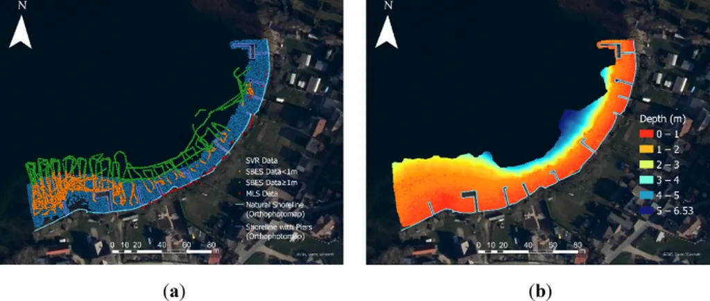
Specht and her team have developed a method that leverages data from Single-Beam Echo Sounder (SBES), MultiBeam EchoSounder (MBES), photogrammetric cameras, and Light Detection and Ranging (LiDAR) systems, both from Airborne Laser Scanning (ALS) and Mobile Laser Scanning (MLS). These data are collected by unmanned platforms equipped with on-board sensors. The method processes bathymetric and photogrammetric data through three key modules: processing depth data, processing shallow-water data, and determining the coastline. The data are then fused using an original weighted average data fusion method, where weights for individual data sources are determined based on measurement accuracy.
“This method not only minimizes redundant geospatial inputs but also ensures that the most accurate data is prioritized,” Specht explained. “The parametric nature of the model allows for flexibility and adaptability, depending on the specific requirements of the coastal monitoring project.”
The implications of this research are significant, particularly for the energy sector. Accurate bathymetric data is crucial for offshore wind farm development, underwater cable laying, and other marine infrastructure projects. By providing more precise and reliable bathymetric maps, this method can reduce the risks and costs associated with these ventures. “The energy sector stands to benefit greatly from this technology,” Specht noted. “It enables more informed decision-making and enhances the overall efficiency of marine operations.”
The study’s findings highlight the potential for future developments in coastal monitoring technologies. As unmanned systems and sensor technologies continue to advance, the integration of multisensor data fusion methods could become a standard practice in hydrography. This could lead to more comprehensive and accurate coastal zone mapping, supporting a wide range of applications from environmental monitoring to disaster management.
In summary, Specht’s research represents a significant step forward in the field of coastal bathymetric monitoring. By addressing the limitations of existing methods and introducing a novel approach that prioritizes measurement accuracy, this study paves the way for more reliable and efficient coastal mapping. As the energy sector continues to expand into marine environments, the adoption of such advanced technologies will be crucial for sustainable and safe operations.